GIS & Mapping Services
We specialize in aerial photo and video, orthomosaics, digital elevation models and natural resource mapping.
General Services
Topographic Surveying and Mapping
Restoration areas - documentation of resource recovery, riparian zones
Roadways and Timber harvest accessibility
Digital Terrain Modeling
High Quality Orthophotography
RTK rectified ground control
Accuracy reporting
GIS Services
GIS Needs Assessments and Implementation Planning
GIS Analysis and Model Development
GIS and GPS Training
GIS/GPS Field Data Collection Systems
Web-based GIS
Forestry Services
Structure from motion
Canopy Height Models
Tree Height
Lidar (future)
Terrain Modeling
Stand Volume (board feet)
Habitat Detection
Multispectral Orthoimagery
Environmental Services
Land Management GIS Support and Analysis
Ecological Modeling
GIS/GPS Field Data Collection Systems
A Small Sample of Our Work
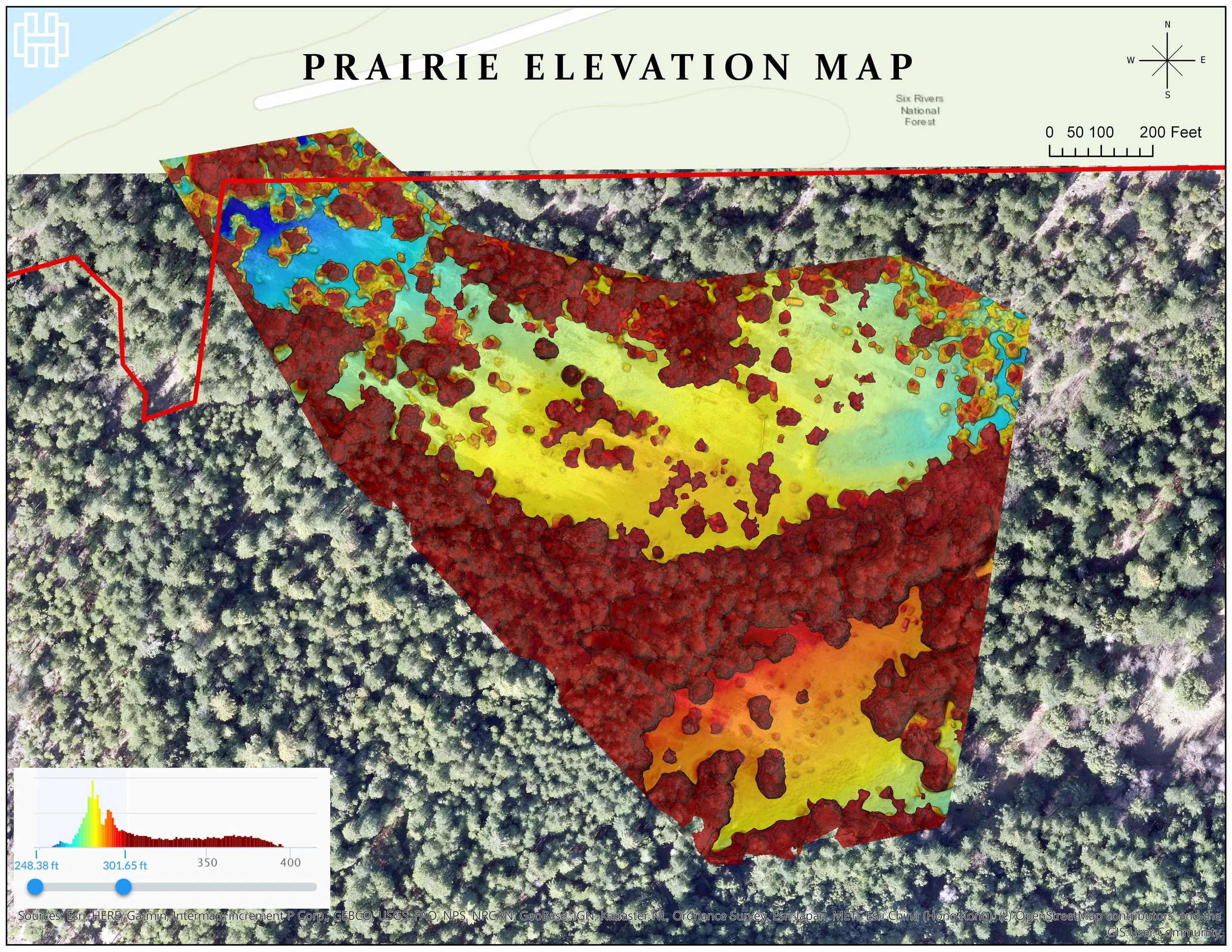
Smith River
South Fork of the Smith River
S. Fork of the Smith River
S. Fork of the Smith River
S. Fork of the Smith River

Middle Fork of Smith River showing property boundaries.
Caspar Creek

United States Forests Service - Caspar Creek Experimental Watershed, Mendocino CA. Map by James Lamping.
United States Forests Service - Caspar Creek Experimental Watershed, Mendocino CA. Map by James Lamping.
United States Forests Service - Caspar Creek Experimental Watershed, Mendocino CA. Map by James Lamping.
Defensible Space Map for Blue Lake Casino

Defensible Space Map for Blue Lake Rancheria. Map made by Oren Nardi.
Defensible Space Map for Humboldt County’s FLASH Program
Defensible Space Map for Humboldt Counties FLASH program. Map by Mia Wapner.
Defensible Space Map for Humboldt Counties FLASH program. Map by Mia Wapner.
Digital Elevation Model for Rock Quarry

Digital Elevation Model of a Rock Quarry in Blue Lake CA to get rock pile volume estimates.

Masters Degree Research by James Lamping.

